インド・パナジ市(Panaji)でスマートシティ化を促進するImagine Panaji Smart City Development(IPSCD)は、
市税徴収の改善と税金滞納者の特定のため、地理情報システム(GIS)によるマッピングを開始することを決定しました。
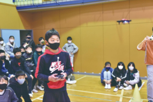
戸別訪問調査に加え、LIDAR(光で距離を測定するリモートセンサー装置)搭載のドローンを用いることによって、
全ての不動産資産が適正に査定できるようになれば、課税対象が90%増加するという試算もあり、
このプロジェクトが成功すれば、税率そのものは据え置きのまま自治体の税収アップが可能となる見通しです。
Corporation of the City of Panaji(CCP)によると、皮肉にも政府が一番の税金滞納者であるとのこと。
CCPのディパック・デッサイ委員長は、これまでは適切な査定機関がなかったことにより、税金の滞納率が高かったと指摘しています。
GISマッピングで集められたデータはすべてデータベースに保存され、公益事業の選定にも利用可能。
このシステムは、CCPの管轄区域を中心に今年10月までに完成する見込みです。
Drone-based GIS mapping of Panaji on cards under Smart City Mission
Panaji: Imagine Panaji Smart City Development (IPSCD) limited has decided to take up geographic information system (GIS) mapping of the capital to improve municipal tax collection and to identify municipal tax defaulters. Ironically, the Corporation of the City of Panaji (CCP) has stated that the government is the biggest defaulter when it comes to paying house and sanitation tax.
IPSCD, the special purpose vehicle formed to implement the Smart City Mission, on Monday announced that it would create a GIS-based masterplan for the capital. “The idea is to do a door-to-door survey and equip the municipal corporation with smart technologies such as low flying, LIDAR-based drone services to ensure that all properties comes under the tax radar and to ensure that all the properties are assessed at the correct rate,” chief executive officer of IPSCD Swayandipta Pal Chaudhuri said.
Chaudhuri expects the entire exercise of municipal tax and fee improvement to “increase the coverage of under assessed and un-assessed properties by 90%. Without any increase of taxes, it is expected that the current revenue of the municipal corporation will increase multifold.”
CCP commissioner Dipak Dessai offered a different viewpoint. “Our main problem (tax recovery) is government buildings. As per the CCP Act, there is a provision for the formation of a government authority that will assess the tax to be paid by government quarters and offices. This authority has never been formed. So that is why our percentage of recovery, our arrears have gone up, otherwise our recovery is very good,” he said.
LIDAR, which stands for Light Detection and Ranging, is a remote sensing device that uses light in the form of a pulsed laser to measure distance. GIS mapping will also be used to identify utility services, which will come in handy while planning the city and giving permissions for digging.
All the data collected will be stored on a digital database. GIS mapping will initially cover CCP’s jurisdiction, including parts of Ribandar and Taleigao, and is expected to be completed by October this year.
原文